KUON GEO › Equal Earth › United States of America
🇺🇸How big is United States of America, really?
United States of America covers 9,439,416 km². It lies between latitudes 18.9°N and 71.4°N, and at those latitudes a Mercator map stretches area by 1/cos²φ, so United States of America appears 2.30 times its true relative size on the map most people grew up with. On the Equal Earth projection, the one the UN General Assembly recommended on 4 September 2026, it is drawn at its true size.
Open the map centred on United States of America Carry it to the equator and watch Compare United States of America with Greenland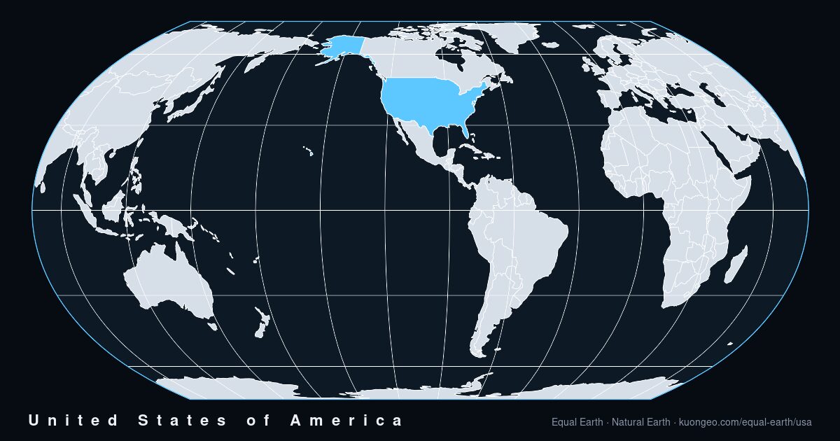
United States of America on Mercator, 2.30 times too large.
The number is not an opinion. We take the outline of United States of America from Natural Earth, project it with the Mercator formula and with the Equal Earth formula on a unit sphere, and divide the two planar areas. Equal Earth is exactly equal-area, so the ratio is the factor by which Mercator inflates the country. For United States of America it is 2.30. A country on the equator would give 1.00; Greenland gives 16.5.
Compared with Greenland, the usual reference: the true ratio of United States of America to Greenland is 4.4 : 1. You can see both on the interactive map, switch to Mercator, and watch the ratio change.
Countries of the same size, and countries that only look the same.
The country closest to United States of America in true area is People's Republic of China (9,371,233 km²).
Population, economy, and how they are changing.
Figures from the World Bank's World Development Indicators (CC BY 4.0). Each value shows the year it refers to. Where an indicator is missing for this country, the row is absent rather than estimated.
| Population | 341,784,857 | 2025 |
| since 2000 | +21.1 % | 2000→2025 |
| Population growth | +0.52 % per year | 2025 |
| Women | 49.8 % | 2025 |
| men per 100 women | 101.0 | 2025 |
| Life expectancy | 78.9 years | 2024 |
| Fertility rate | 1.63 | 2024 |
| Urban population | 80.2 % | 2025 |
| Density | 36.8 per km² | 2023 |
| GDP | US$ 30.8T | 2025 |
| GDP per person | US$ 90,027 | 2025 |
| GDP growth | +2.2 % | 2025 |
| Land area (World Bank) | 9,147,420 km² | 2023 |
Satellites this country owns.
Counted from the CelesTrak satellite catalogue by owner: payloads currently in orbit, those operational, and every payload ever launched. Satellites owned by international organisations or by two countries jointly are not counted for any country. Positioning satellites are from KUON GEO's own catalogue.
| in orbit | 13,733 | |
| operational | 12,880 | |
| launched in total | 17,785 | |
| first launch | 1958-02-01 | |
| positioning satellites (KUON catalogue) | 32 |
FAQ
How big is United States of America really?
United States of America covers about 9,439,416 km², computed by integrating its Natural Earth 1:50m outline on a sphere of radius 6371.0088 km. That places it 4th of 177 countries by area.
How much larger does Mercator make United States of America look?
About 2.30 times its true relative area, because Mercator stretches area by 1/cos²φ and United States of America lies between latitudes 18.9°N and 71.4°N.
Which country is really the same size as United States of America?
People's Republic of China, whose true area is closest to that of United States of America.
Every country
The same page for each of the 177 countries in the dataset, in seven languages.
Africa
Democratic Republic of the Congo ×1.0Algeria ×1.3Sudan ×1.1Libya ×1.3Chad ×1.1Mali ×1.1Angola ×1.1South Africa ×1.3Niger ×1.1Ethiopia ×1.0Mauritania ×1.1Egypt ×1.3Tanzania ×1.0Nigeria ×1.0Namibia ×1.2Mozambique ×1.1Zambia ×1.1South Sudan ×1.0Central African Republic ×1.0Kenya ×1.0Madagascar ×1.1Morocco ×1.3Botswana ×1.2Somalia ×1.0Cameroon ×1.0Zimbabwe ×1.1Republic of the Congo ×1.0Ivory Coast ×1.0Burkina Faso ×1.0Gabon ×1.0Guinea ×1.0Uganda ×1.0Ghana ×1.0Senegal ×1.1Somaliland ×1.0Tunisia ×1.5Eritrea ×1.1Malawi ×1.1Benin ×1.0Liberia ×1.0Western Sahara ×1.2Sierra Leone ×1.0Togo ×1.0Guinea-Bissau ×1.0Lesotho ×1.3Burundi ×1.0Equatorial Guinea ×1.0Rwanda ×1.0Djibouti ×1.0Eswatini ×1.2The Gambia ×1.1Antarctica
Antarctica ×23.5Asia
People's Republic of China ×1.6India ×1.2Kazakhstan ×2.3Saudi Arabia ×1.2Indonesia ×1.0Iran ×1.4Mongolia ×2.1Pakistan ×1.3Turkey ×1.7Myanmar ×1.2Afghanistan ×1.5Thailand ×1.1Turkmenistan ×1.7Yemen ×1.1Uzbekistan ×1.8Iraq ×1.4Japan ×1.6Vietnam ×1.1Malaysia ×1.0Oman ×1.1Philippines ×1.0Laos ×1.1Kyrgyzstan ×1.8Syria ×1.5Cambodia ×1.1Nepal ×1.3Tajikistan ×1.6Bangladesh ×1.2North Korea ×1.7South Korea ×1.5Jordan ×1.4Azerbaijan ×1.7United Arab Emirates ×1.2Georgia ×1.8Sri Lanka ×1.0Bhutan ×1.3Taiwan ×1.2Armenia ×1.7Israel ×1.4Kuwait ×1.3East Timor ×1.0Qatar ×1.2Lebanon ×1.5Palestine ×1.4Cyprus ×1.5Brunei ×1.0Turkish Republic of Northern Cyprus ×1.5Europe
Russia ×4.9France ×2.0Ukraine ×2.3Spain ×1.7Sweden ×4.9Norway ×9.4Germany ×2.5Finland ×5.5Poland ×2.7Italy ×1.9United Kingdom ×2.9Romania ×2.1Belarus ×2.8Greece ×1.7Bulgaria ×1.9Iceland ×5.6Hungary ×2.2Portugal ×1.7Austria ×2.2Czech Republic ×2.4Serbia ×1.9Ireland ×2.8Lithuania ×3.1Latvia ×3.3Croatia ×2.0Bosnia and Herzegovina ×1.9Slovakia ×2.3Estonia ×3.7Denmark ×3.2Switzerland ×2.1Netherlands ×2.7Moldova ×2.2Belgium ×2.5Albania ×1.8North Macedonia ×1.8Slovenia ×2.1Montenegro ×1.9Kosovo ×1.8Luxembourg ×2.4North America
Canada ×5.2United States of America ×2.3Greenland ×16.5Mexico ×1.2Nicaragua ×1.1Honduras ×1.1Cuba ×1.2Guatemala ×1.1Panama ×1.0Costa Rica ×1.0Dominican Republic ×1.1Haiti ×1.1Belize ×1.1El Salvador ×1.1The Bahamas ×1.2Jamaica ×1.1Puerto Rico ×1.1Trinidad and Tobago ×1.0Oceania
Australia ×1.3Papua New Guinea ×1.0New Zealand ×1.8Solomon Islands ×1.0New Caledonia ×1.2Fiji ×1.1Vanuatu ×1.1Open ocean
French Southern and Antarctic Lands ×2.4South America
Brazil ×1.1Argentina ×1.6Peru ×1.0Colombia ×1.0Bolivia ×1.1Venezuela ×1.0Chile ×1.8Paraguay ×1.2Ecuador ×1.0Guyana ×1.0Uruguay ×1.4Suriname ×1.0Falkland Islands ×2.6Outline and area: Natural Earth (public domain); area integrated on the sphere from the 1:50m outline. Mercator factor: ratio of planar areas under the Mercator and Equal Earth formulas. Statistics: World Bank WDI (CC BY 4.0). Satellites: CelesTrak SATCAT. Map images rendered by this site from the same data. · 2026-09-06