KUON GEO › Municipalities of Japan › Tatebayashi City
Japan · municipality · Gunma
Tatebayashi City
館林市 · タテバヤシシ
Tatebayashi City is a city in Gunma, Japan. This page gathers what is measured here: the warnings the Japan Meteorological Agency has in force at this moment, the nearest station's latest observation, the hazard zones, the population, the nearest free RTK base, and what goods cost. Everything is joined by the municipality code and refreshed from the same open endpoint that answers Here, now.
Rain radar, rainfall and warnings in Tatebayashi City now (2026-10-06 21:20 JST)
Warnings and advisories: none in force for Tatebayashi City (JMA 2026-10-05 09:12 JST)
Rainfall: last hour 0.0 mm, last 24 hours 0.0 mm (AMeDAS Tatebayashi・1.8 km・2026-10-06 21:10 JST)
Linear rainband: no JMA weather information for 群馬県 has mentioned a linear rainband in the last 48 hours (checked 2026-10-06 21:20 JST). JMA announces linear rainbands, and the half-day-ahead outlook, in its weather information.
Rain radar: Rain radar around Tatebayashi City (2026-10-06 21:10 JST)
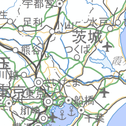

Radar: RainViewer (about every 10 minutes). Map: GSI. The red dot is the centre of Tatebayashi City. Open the moving rain radar map
Flood, tsunami and landslide hazard zones (assumed)
Flood (maximum assumed scale): this point is inside a flood-hazard zone, with an assumed depth of 3.0 to 5.0 m. (Hazard Map Portal Site, maximum assumed scale)
Tsunami: this point is outside the tsunami inundation zone even for the largest-class tsunami. (Hazard Map Portal Site, largest class)
Landslide: this point is outside the sediment-disaster hazard area. (National Land Numerical Information A33)
This shows the "maximum assumed scale" zone, a different document from the record of floods that actually happened (a jisseki-zu). Actual-flood records are published separately by each municipality or river authority. Since 28 August 2020, Japanese real-estate transactions have been legally required to show a property's position on the flood hazard map as part of the mandatory disclosure. This screen can be a starting point for that check, but the authoritative source is each municipality's own hazard map. Open the map here with the hazard layers on
Facts
Right now
Read live from the open endpoint for the centre point of this municipality. Warnings apply to the whole warning area; the observation is the nearest station's own reading.
Reading…
Warnings and advisories in force
Nearest observation
Heat (WBGT)
Earthquakes within 300 km, 7 days
This town so far: what has accumulated
KUON GEO keeps the originals and counts them every day. Only what has accumulated is shown, with the start date; the numbers grow from here.
Reading…
If you live here
Hazard zones are a property of the exact address, not of the municipality, so this page does not summarise them. Open the point card for any address, or the map with the hazard layers on.
Outside a zone does not mean safe. The authoritative source is the municipality's own hazard map.
What it costs here
From kurashigram, the sister project that measures prices in Japan from primary sources. Today it reads furusato-nozei (hometown tax) return goods listed by this municipality and normalises them to grams per 10,000 yen.
Reading…
Positioning here
For engineers: the nearest free RTK base station, and the guide to using GNSS in Japan.
Where to go next
The live values on this page come from one open endpoint: https://kuongeo.com/api/here?lat=36.2449&lon=139.5321&lang=en
Neighbouring municipalities
Meiwa Town 4 kmOra Town 6 kmItakura Town 8 kmChiyoda Town 8 kmHanyu City 8 kmOizumi Town 11 kmGyoda City 12 kmAshikaga City 14 km
All municipalities in Gunma (35)
Maebashi CityTakasaki CityKiryu CityIsesaki CityOta CityNumata CityShibukawa CityFujioka CityTomioka CityAnnaka CityMidori CityShinto VillageYoshioka TownUeno VillageKanna TownShimonita TownNammoku VillageKanra TownNakanojo TownNaganohara TownTsumagoi VillageKusatsu TownTakayama VillageHigashiagatsuma TownKatashina VillageKawaba VillageShowa VillageMinakami TownTamamura TownItakura TownMeiwa TownChiyoda TownOizumi TownOra Town
Police boxes and stations
Police in this municipality: 4 koban, 3 residential posts, 2 stations
Sources
Boundaries: MLIT National Land Numerical Information, administrative areas (1 January 2021), simplified. Population: e-Stat, 2020 Population Census. Area names: Japan Meteorological Agency area table (22 August 2026). Municipality codes and readings: Ministry of Internal Affairs and Communications (1 January 2024). Live values: Japan Meteorological Agency, Ministry of the Environment, USGS, kurashigram.com, KUON GEO.
Warnings and advisories are relayed as published by the Japan Meteorological Agency; KUON GEO does not issue them. The official source is jma.go.jp.