The live map of the world's
community RTK base stations.
Free · token-less · in your browser. Live status and cm-grade coverage of community NTRIP stations, weather radar nowcast, and centimeter-scale RTK log plotting — on one map.
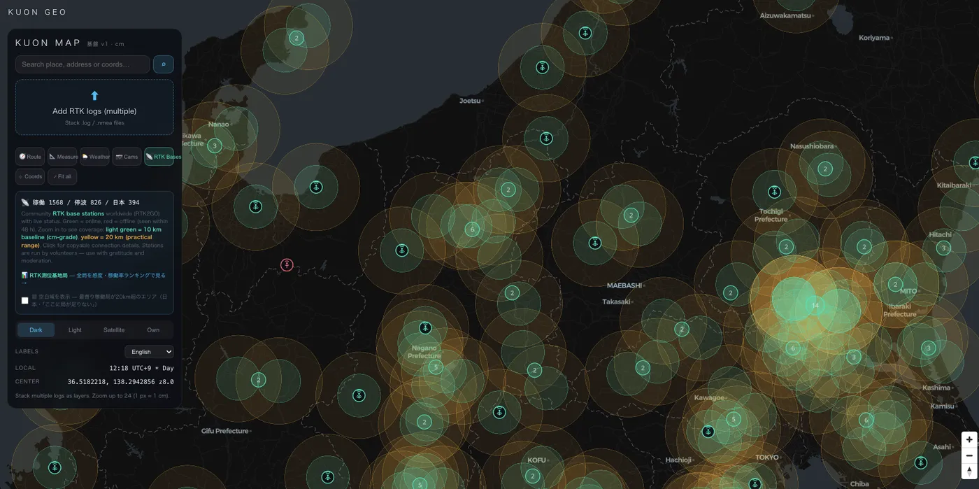
KUON GEO monitors 2,000+ community RTK base stations across four public NTRIP casters — RTK2GO, BizStation (Japan), GeoRTK (Japan) and Centipede-RTK — polling every 10 minutes, and publishes live status, uptime history and a 0–12 sensitivity score for every station, free of charge.
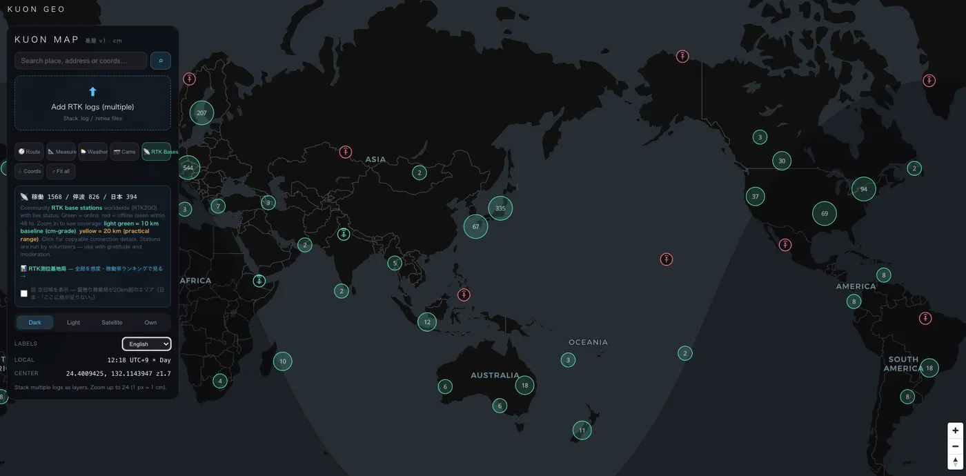
Every community base station, live
Green means online, red means offline — refreshed continuously from public sourcetables. Zoom in for 10 km (cm-grade) and 20 km (practical) baseline circles, click any station for copyable NTRIP connection details.
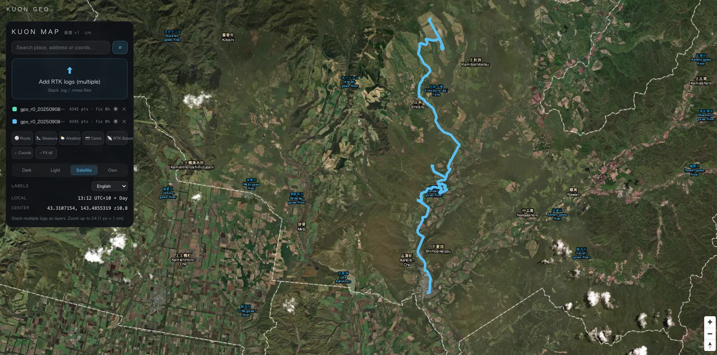
Plot RTK logs at 1 px ≈ 1 cm
Drop .log / .nmea files onto the map and stack multiple tracks as layers. Zoom to level 24 where one pixel is roughly one centimeter — see what your rover actually did.
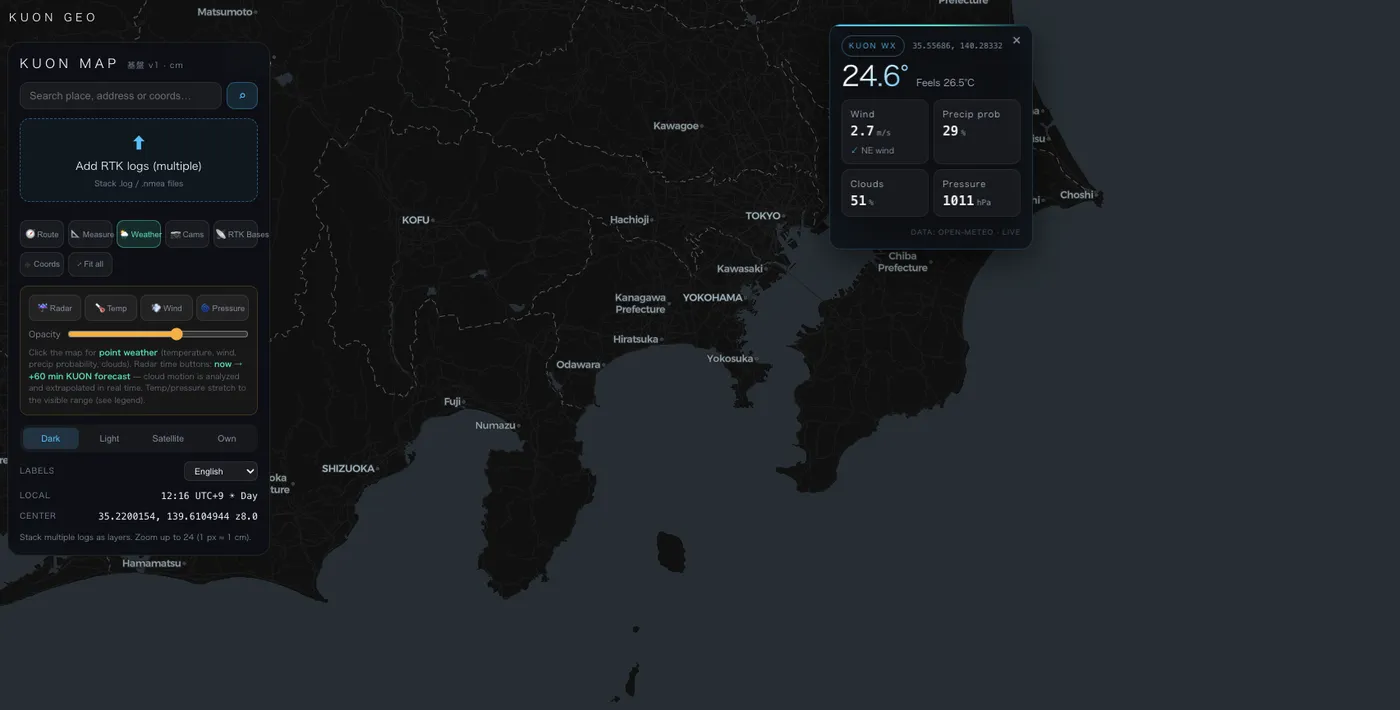
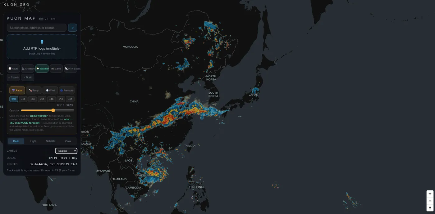
Weather that matters to GNSS
Radar with KUON's own short-term nowcast, temperature and pressure fields, wind streamlines — click anywhere for point conditions. Built by a team that archives GNSS data for atmospheric research.
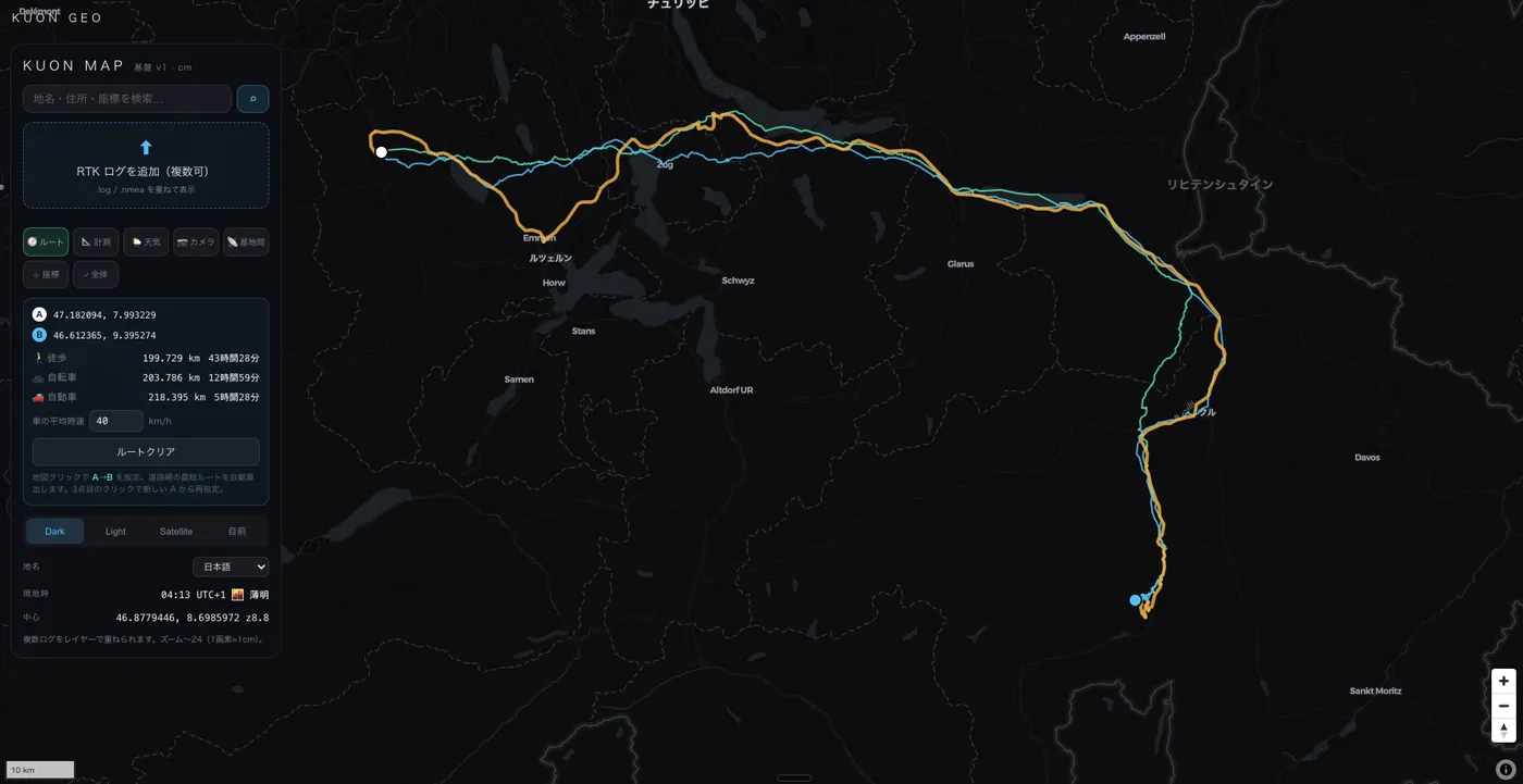
Routes, measurement, coordinates
A→B routing with walk/bike/car times, geodesic distance measurement between RTK points, and a coordinate reticle that reads DMS, UTM, MGRS, Plus Codes and ECEF in real time.
KUON ORBIT — the sky, live
Watch GPS, GLONASS, Galileo, BeiDou, QZSS and the ISS orbit in real time (SGP4 propagation), with QZSS drawing its figure-eight over Japan. The satellites your rover hears, made visible.
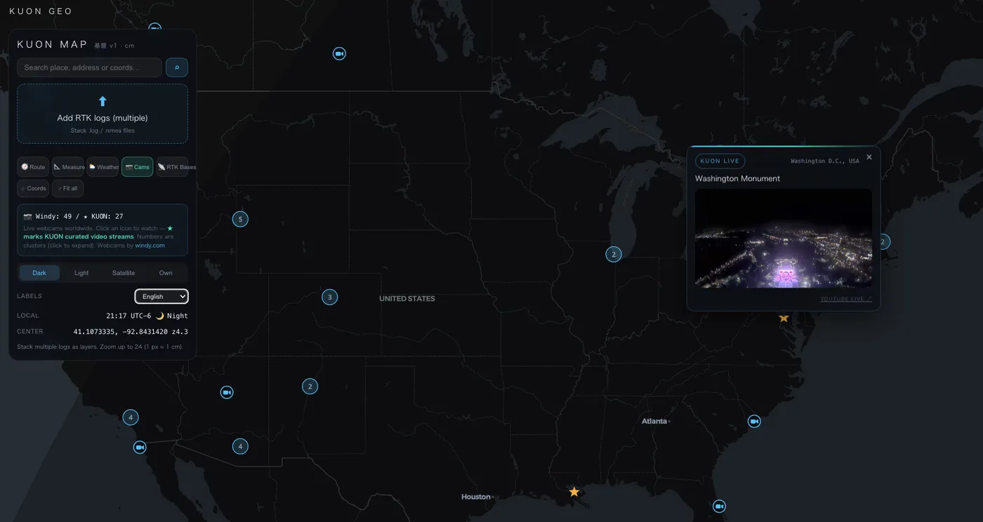
Live cameras & more
Curated live cameras around the world, day/night terminator, six languages for map labels — small things that make one map feel like the whole planet.
Run a base station? This is for you.
Every station gets a permanent page with a 60-day uptime heatmap and a live badge — free, updated every 10 minutes. Embed it in your blog, forum signature or README. Community base stations are a public good; this board exists to celebrate them. Everything shown is a record of public information and our own observations — never a judgement of your work.
FAQ
What is KUON MAP?
A free, browser-based map combining community RTK base stations (live status + coverage), weather radar nowcast, cm-scale RTK log plotting, routing and satellite tracking. No account, no API token.
Which networks are monitored?
RTK2GO, BizStation (Japan), GeoRTK (Japan) and Centipede-RTK (worldwide) — public sourcetables polled every 10 minutes.
How is the sensitivity score calculated?
From each station's RTCM message set: MSM7 +3 / MSM4·5 +2, one point per GNSS constellation (GPS/GLO/GAL/QZS/BDS), +2 for station coordinates (1005/1006), +1 for a high-grade receiver. Maximum 12.
Can I get my station removed or corrected?
Yes — email 369@kotaroasahina.com and we respond promptly. Listings are based on public NTRIP sourcetables.
Who runs this?
KUON GEO (Kuon R&D) in Obihiro, Hokkaido, Japan — we also archive raw GNSS data every day for atmospheric research (precipitable water vapor, snow sensing).